Geo Aviator
A data intelligence system for analysing aviation disruption, crisis events and operational impact.
A multi-source aviation data workflow that transforms fragmented disruption and crisis datasets into structured information for analysis, modelling and decision support.
Geo Aviator was developed to bring fragmented aviation disruption and crisis data into a single analytical environment. Multiple datasets covering airport disruption, airspace closures, conflict events, flight cancellations, rerouting and operational impacts are cleaned, standardised and connected so they can be explored together.
The project develops this structured data foundation into an intelligence workflow for exploratory analysis, scenario modelling and decision support.
How Geo Aviator works
Bring the evidence together
Multiple aviation, disruption and crisis datasets are brought into one analytical workspace.
Make the sources compatible
Different schemas, fields and formats are cleaned and standardised into consistent structures.
Mind Map
Before building the data workflow, I mapped the problem by hand to understand what information I had, what was missing and how the different datasets might connect.
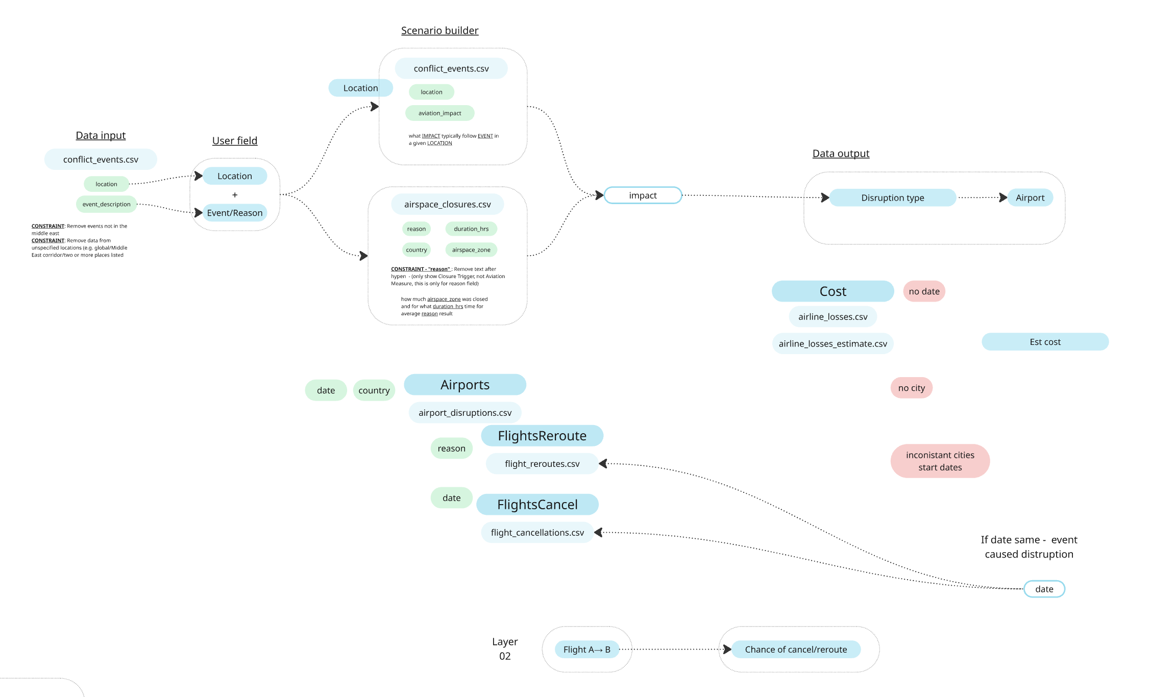
What information do I have?
I started by looking inside each dataset to see what it contained — things like locations, dates, flight disruptions, airspace closures and costs.
What information is missing?
Some datasets had no dates, others used different place names, and some information could not be connected directly. I marked these gaps before deciding what could be analysed.
What connects to what?
I looked for shared clues such as location, date, reason and impact that could connect one dataset to another.
How could one event affect another?
I mapped possible chains such as a conflict event causing an airspace closure, which could then affect airports, reroute flights or increase cancellations.
This working map helped turn a collection of separate CSV files into a structured plan for cleaning, connecting and analysing the data.
Build one connected dataset
Records from different sources are transformed and connected through dates and shared aviation context.
Understand what happened
Search, filtering and exploratory tools reveal relationships between disruptions, closures, reroutes and operational impacts.
Explore what could happen next
The structured dataset provides a foundation for model building, comparison, validation, explainability and scenario testing.
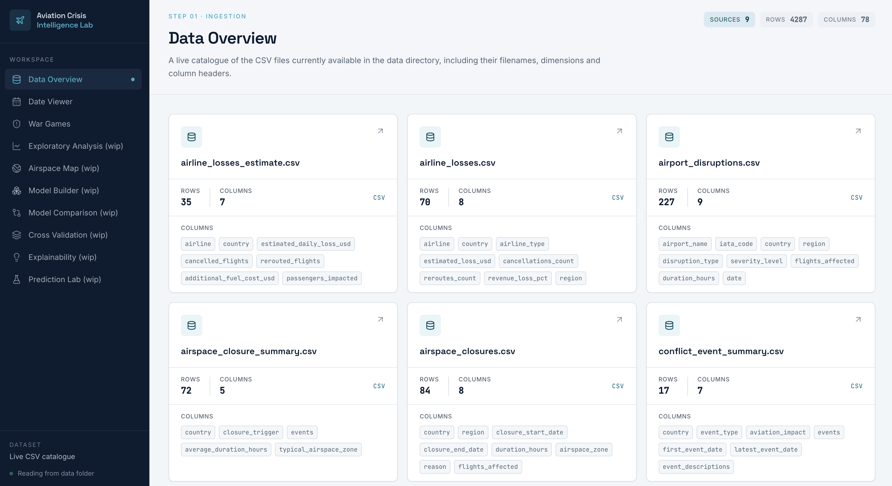
Source datasets are catalogued with their dimensions and fields, making the underlying data structure visible before analysis.
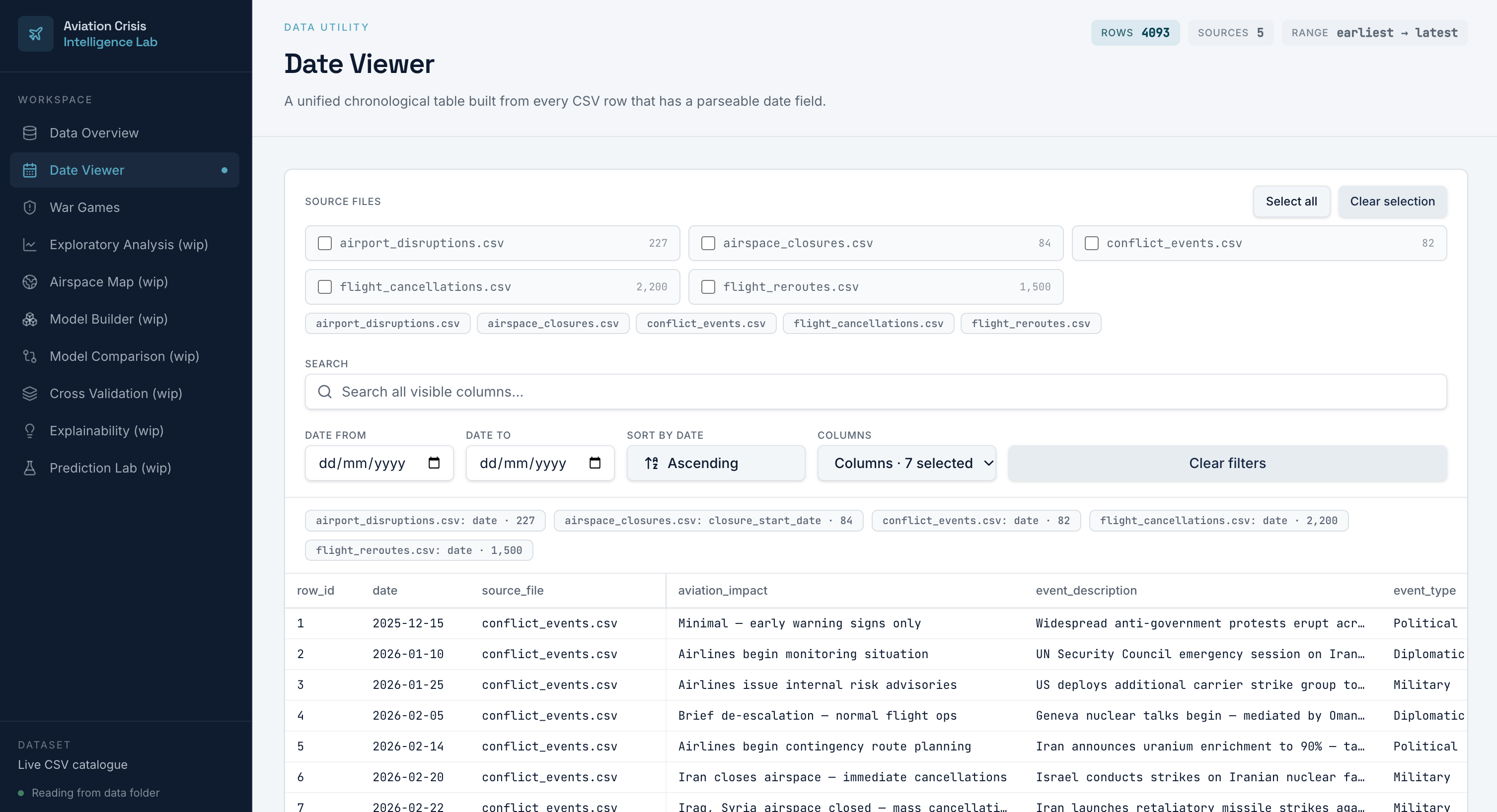
Records with compatible date fields are transformed into a unified chronological dataset with source selection, search, filtering and configurable columns.
The structured data layer provides the foundation for exploratory analysis, model development, comparison, validation and explainability.